[372]
CHAPTER XXIV.
OLD BRITISH GLACIERS.
THOSE who have closely observed the Highlands of Scotland and of Cumberland, may remember
that, though the weather has had a powerful influence, rendering the mountains in places
rugged, jagged, and cliffy, yet, notwithstanding this, their general outlines are often
remarkably rounded, flowing in great and small mammillated curves, a configuration of ground
tolerably plain in the accompanying view (fig. 80), especially in the rocks of the island in the
foreground. When we examine the valleys and plains in detail we also find that the same
mammillated structure frequently prevails. These rounded forms are known in Switzerland as
roches moutonnées, a name now in general use among those who study the action of glacier-ice.
Similar icesmoothed rocks strike the eye in many British valleys, marked by the same kind of
grooving and striation, so characteristic of the rocks of Switzerland. Almost every valley in the
Highlands of Scotland bears them, and the same is the case in Cumberland, Wales, and other
districts in the British Islands, and not in the valleys alone, but also in the low countries as far
as Liverpool and the middle of England.
Considering all these things, geologists, led many years ago by Agassiz, have by degrees come to
the
[373]
FIG. 79.
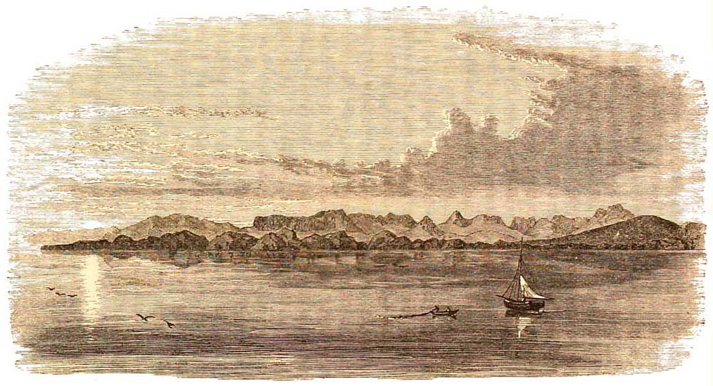
Mountains of Ross-shire, with the Island of Rona in front.
[374 Old British and]
conclusion that large parts of the northern hemisphere were, during the 'glacial period,' more
or less covered, or nearly covered, with a coating of thick ice, in the same way that the greater
parts of Greenland, Spitzbergen, and the whole of Victoria Land are covered at present. Britain
formed part of this area, and, by the long-continued grinding power of great glaciers nearly
universal over the northern half of our country and Wales, the whole surface became moulded
by ice. The relics of this action still remain strongly impressed on this country to attest its
former power, and I need scarcely say that the same kind of phenomena are equally striking in
Ireland.
It might be unsafe to form this conclusion merely by an examination of such a small tract of
country as the British Islands, but when we consider the great Scandinavian chain, and the
northern half of Europe generally, we find that similar phenomena are common over the whole
of that area, and in the North American Continent, as far south as latitude 38° or 40°; for when
the soil, or the superficial covering of other debris is removed, we discover over large areas
that the solid rock is smoothed and polished, and covered with grooves and striations, similar to
those of which we have experience among the glaciers of the Alps. I do not speak merely by
common report in this matter, for I know it from personal observation, both in the Old
Continent and the New. We know of no power on earth, of a natural kind, which produces these
indications except moving ice, and therefore geologists are justified in attributing them, even
on this great continental scale, to ice-action.
This conclusion is fortified by many other circumstances. Thus, I have stated that in the Alps
there is
[Other Glaciers. 375]
evidence that the present glaciers were once on an immensely larger scale than at present. The
proof not only lies in the polished and grooved rocks far removed from the actual glaciers of the
present day, but also in numerous moraines on a scale so immense that the largest now forming
in the Alps are of pigmy size when compared with them. Such a moraine is the great one of the
Dora Baltea, sometimes called the Moraine of Ivrea, which, on the plains outside the mouth of
the Val d'Aosta, encloses a circuit of about sixty miles, and rises above the plain more than
1,600 feet in height, being altogether formed of mere accumulations of moraine rubbish. Its
width in places averages about seven miles, as mapped by Gastaldi. Many others might be cited.
The same kind of phenomena occur in the Altai Mountains, the Himalayah, the Caucasus, the
Rocky Mountains, the Andes, the Sierra Nevada, and the Pyrenees of Spain, the Atlas of Morocco,
the mountains of Sweden and Norway, the Black Forest and the Vosges, and in many other
northern mountain chains or clusters, great or small, that have been critically examined. In the
southern hemisphere, where mountain ranges are comparatively scarce, the same ancient
extension of glaciers is prominent in New Zealand. Therefore there can be no doubt that at late
periods of the world's history a climate or climates prevailed over large tracts of the earth's
surface generally, but not always, of extreme arctic severity, for there were intermittent
episodes of comparative warmth, when what is misnamed perpetual snow disappeared, or almost
disappeared from mountain regions of moderate height. The cold of these minor cycles in time
(for as shown by Dr. Croll, glacial cycles alternate in the northern and southern hemispheres)
was produced by causes about which there have
[376 Cause of Glacial Epochs.]
been many guesses, and which, perhaps, are only now beginning to be understood.
It is not very many years, since a great difference in the geographical distribution of land and
sea was regarded as a possible or even a probable cause of the occurrence of important changes
of climate during Geological Time. If, said Lyell, in his earlier writings, all the continental
lands, were gathered in tropical regions, and the rest of the globe were mainly covered by sea,
the climates of the world would he tropical and temperate according to their latitudes, and if all
the land were mainly massed round the poles, even in the tropics there would be no tropical heat
such as they now endure, while the greater portions of the northern and southern hemispheres
would suffer from climates of extreme severity. In such a sketch as this it is needless to argue
the question, at all events as regards this special glacial epoch, for the obvious reason that it is
an established fact that during most of that epoch, the continents of the world, mountain chains
and all, were distributed much as they are at present, with occasional minor variations in detail
due to short local submergences.
Neither is it worth while to discuss the facile explanation of variation of climate, being due to
the sun with all its planets travelling through alternate hot and cold regions of space. Such an
idea crops out now and then in conversation, but I do not remember to have met any educated
physicist who seriously entertained it.
I believe that the day may come, when both astronomers and geologists will be forced to allow
that, in great cycles of geological time, changes have taken place in the position of the earth's
axis of rotation, in a slowly cumulative manner, by gradual disturbances of
[Cause of Glacial Epochs. 377]
what is called the crust of the earth, but by no means by sudden upheavals of vast mountain
tracts at or near the poles, or anywhere else on the earth's surface; and, indeed, the phenomena
of the vegetation of old geological epochs in formations as far north as land has been discovered,
seems to me to point in that direction and in no other. At all events it is plain, that no such
sweeping changes of physical geography have taken place in those comparatively short episodes
of geological history, that have graduated into, each other from the beginning of this latest
glacial epoch down to the present day, and therefore it is needless to discuss the question here.
There is, however, an astronomical cause which seems to meet all the circumstances of any one
glacial epoch, and is therefore deserving of the gravest attention. The question has been worked
out with great skill by Dr. James Croll, first, in various memoirs, and latterly, in his
celebrated work 'Climate and Time,' and I can only state in a very sketchy manner some of his
main conclusions.
Alternations of cold and warm or temperate climates, in the same latitudes, are in the first
instance due to the varying eccentricity of the orbit of the earth, by which 'a host of physical
agencies are brought into operation, the combined effect of which is to lower to a very great
extent the temperature of the hemisphere whose winters occur in apheliou, and to raise to
nearly as great an extent the temperature of the opposite hemisphere, whose winters of course
occur in perihelion.' It is perhaps possible that the orbit of the Earth may become circular, at
periods of time prodigiously far removed from each other, but at present, when the earth in its
elliptical orbit is
[378 Cause of Glacial Epochs.]
furthest from the sun (aphelion), the distance is about 90 millions of miles, and its smallest
distance (perihelion) is about 89,864,480 miles. The varying amount of ellipticity is owing to
the ever-changing positions of the planets in our solar system within and without the orbit of
rotation of the earth, and we can imagine a state of combination of the planets, the effect of the
attraction of which must be to lengthen the ellipse in the extremest possible degree, so that the
earth in aphelion would be 98 1/2 millions of miles distant from the sun. This is not a mere guess,
for it has been approximately calculated by Leverrier and other astronomers. The eccentricity
of the earth's orbit is at present decreasing, and it will reach its minimum in about 24,000
years.
In connection with degrees
of eccentricity, Dr. Croll argues that the distribution of ocean-currents
is due to the system of winds, and in the modern world the existing system
of winds is due to those astronomical causes that, by help of eccentricity
have produced a minor glacial epoch in part of the southern hemisphere at
the present day, and a remarkably mild one over Western Europe and great
part of the north. This coincidence of winds and great ocean currents is
shown by Dr. Croll in a map, the most familiar of which to us, being the
westerly and southwesterly winds and currents of the Gulf Stream, the warm
winds from which so largely raise the average temperature of the British
Islands and the whole of the western part of Europe. There being nothing
equivalent to this current running south towards the great Antartic Continent
of Victoria Land, this circumstance, taken in connection with the fact that
the southern winter occurs in aphelion, has produced in that region a minor
glacial epoch, so that in south latitudes, between about 64° and 78°, the
[Cause of Glacial Epochs. 379]
whole country is nearly entirely shrouded in glacier-ice, and is altogether uninhabitable by
man, while in the northern hemisphere, in equivalent latitudes, there are no parts of North
America and Europe totally uninhabited, and even the north of Norway in summer, when the sun
does not set, is often inconveniently warm, and the traveller is troubled with clouds of
mosquitoes.
The present winter of the southern hemisphere being when the earth is in aphelion, the result
is this, that the winter of the Antipodes is seven or eight days longer than our own, for the
further the earth is removed from the sun, the more slowly it moves in its orbit, and the
nearer it is, it moves in proportion more rapidly, and this somewhat lengthened winter,
coupled with the absence of heated water flowing south from equatorial regions, has enabled the
snows to accumulate, and being but little affected even by the summer's sun, the country is
continually buried in ice, while in Norway and on the shores of the Baltic, in equivalent
latitudes, forests, grass, and crops abound. The winter of our northern hemisphere is of course
seven or eight days shorter than that of the south, and the earth is at that season with us nearest
to the sun, and our summer being a little longer though further from the sun, the effect of its
heat corresponds to the difference, irrespective of the powerful effect of the heated water of the
Gulf Stream.
If such marked results are produced with this comparatively small amount of eccentricity, it is
reasonable to suppose that with the greatest possible eccentricity the effect must be much
greater, and it has been calculated that when this by slow degrees takes place, the earth in
aphelion is distant from the sun about 98 1/2 millions of miles, or nearly 7 millions of miles
further
[380 Glacial Epoch in Britain.]
from the sun than when eccentricity is at a minimum, or about 8 1/2 millions further than its
greatest distance now. The earth, therefore, in aphelion would be more than 14 millions of
miles farther from the sun than when in perihelion, and if, in accordance with the precession of
the equinoxes, it so happened that winter in the northern hemisphere took place when the earth
is furthest from the sun, then by calculation it has been shown that 'the direct heat of the sun in
winter would be one-fifth less during that season than at present, and in summer one-fifth
greater.' But this extra amount of heat in summer would even less have sufficed to remove the
snow and ice then, than it suffices to remove it from Victoria Land at the present day; for just as
that region is all summer apt to be involved in clouds and fogs by vapours, due to partial
evaporation of melting snow, even so on a greater scale the same effect must have been produced
in old epochs, when greater glacial epochs took place alternately in the northern and southern
hemispheres.
It was during part, or in parts of one of these periods, that great part of what is now the British
Islands, was last almost entirely covered with ice, for, as I have already shown, similar
phenomena are periodical, and have occurred in several old geological epochs. I do not say that
our area consisted of islands during the whole of the last Glacial epoch, and probably during part
of it they were united with the Continent, and the average level of the land may then have been
somewhat higher than at present, by elevation of the whole, and also because since the first
appearance of British glaciers it has suffered much degradation; but whether this was so or not,
the mountains and much of the lowlands were long covered with a universal coating of ice,
[381]
FIG. 80.
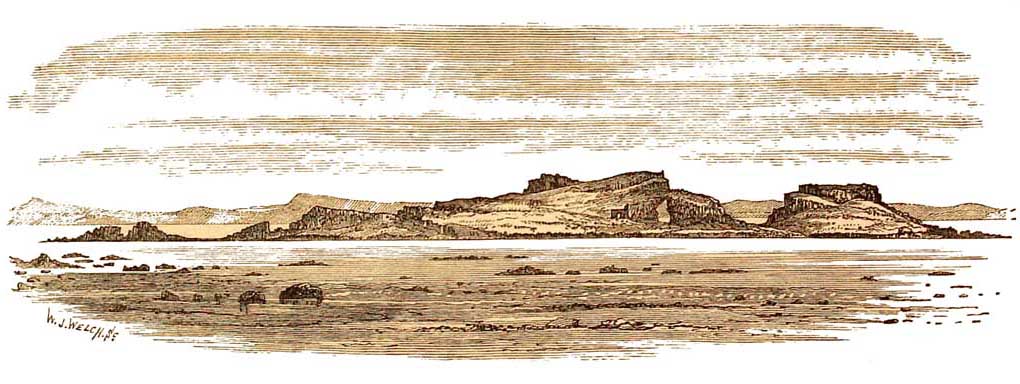 Fidra Island, North Berwick, Firth of Forth.
[382 Glacial Epoch in Britain.]
probably as thick as that in the north of Greenland in the present day. During this time all the
Highland mountains were literally buried in ice, which, partly flowing eastward, joined a vast
ice-sheet coming westerly and southerly from Scandinavia. In another direction a thick sheet of
the same Highland ice pressed southward into the valley of the Tay, where a low stratum of the
glacier passed eastward to the sea, while the remainder pressed up the slopes and across the
summits of the Ochil Hills, and on to the valley of the Forth, where it found a vent for a further
outflow to the east, at a time when the Bass Rock, Fidra Island, Inch Keith, Inch Colon, and all
the other beautiful islands of tbe Firth of Forth, lay as mere roches moutonnées, buried so deep
under glacier-ice that it overflowed the eastern part of the Lammermuirs and spread southward
into Northumberland. Some of these islands still retain their ice-worn surfaces, while others,
such as the Bass and Fidra, have become scarred and cliffy by the action of weather and the sea
(figs. 80 and 81). Another part of the great glacier-ice passed west across the Hebrides, and
southerly into the Firth of Clyde, where, passing over Bute, and smothering and smoothing those
large mammillations the Cumbraes, it was reinforced by the snows of Arran, and buried that
'craggy ocean pyramid,' Ailsa Craig. All the southern Highlands, from Fast Castle on the east to
Wigtonshire on the west coast, were also covered with glacier ice, together with
Northumberland, Durham, and the beautiful dales of Yorkshire, scooped out of the
Carboniferous series of rocks. Cumberland too was buried in ice, part of which crossed the vale
of Eden and over the hills beyond, carrying detritus to the eastern shore of England. So great was
this ice-sheet that, joining with the ice-stream
[383]
FIG. 81.
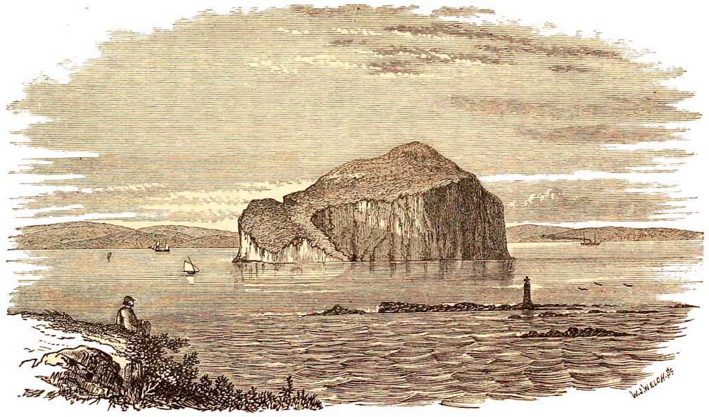
Bass Rock, Firth of Forth.
[384 Glacial Epochs.]
coming from what is now the basin of the Clyde, it stretched away south so far that it
overflowed Anglesea, and, so to speak, overcame the force of the smaller tributary glaciers that
descended from the mountains of North Wales; for the glacial striations of Anglesea point not to
the Snowdonian range, but about 25° to 30° east of north, directly toward the mountains of
Cumberland. South of Wales, in England, I know of no definite signs of the direct action of
glaciers.
Much of the Lower Boulder-clay is known as 'Till ' in Scotland; and it was only by slow degrees
that geologists became reconciled to the idea that this Till is nothing but moraine rubbish on a
vast scale, formed by those old glaciers that once covered the northern part of our country. In
fact, Agassiz, who held these views, and Buckland who followed him, were something like twenty
years before their time; and men sought to explain the phenomena of this universal glaciation
by every method but the true one. Mr. Robert Chambers was, I think, the first after Agassiz who
asserted that Scotland had been nearly covered by glacier ice, and now the subject is being
worked out in all its details, thus coming back to the old generalised hypothesis of Agassiz,
which is now accepted by many of the best geologists of Europe and America.
The general result has been
that the whole of the regions of Britain mentioned1 have literally been moulded by ice, that is to say, the country in many parts was so much ground
by glacieraction, on a continental scale, that though in later times it has
been more or less scarred by weather, enough remains of the effects to tell
to the observant eye the greatness of the
1 And equivalent regions in Ireland which in this book it is not my object to describe.
[Boulder-Clay. 385]
power of moving ice. Suddenly strip Greenland of its ice-sheet, and it will present a picture,
something like the greater part of Britain immediately after the close of this Glacial period.
During the time that these results were being produced by glacial action, there were occasional
important oscillations in temperature, so that the ice sometimes increased and sometimes
diminished, and land animals that lived habitually outside the great glacier limits, at intervals
advanced north or retreated south with the retreating or advancing ice.
Evidence of the same kind is not wanting in England, for erratic stones and large blocks of
granite, gneiss, felspathic traps, Carboniferous Limestone, &c. are scattered over the west and
east coasts and the central counties of England. Boulders of Shap granite of Cumberland are
common in Staffordshire, and even in the valley of the Severn, about twelve miles north of
Cheltenham, and they have also been borne across the central watershed of the north into the
plains of Yorkshire, near Darlington, and further south on the banks of the Humber. This
distribution of erratic stones, on the east of England, throws much light on the subject of the
motion of large sheets of glacier-ice, and therefore it is worth while to give a few details, some
of which are probably not generally known.1
At and a little south of Berwick-upon-Tweed,
where the sea-cliffs are clear, or, when the Till has been re moved, the
surfaces of quarries of Carboniferous Limestone are found to be icepolished
and grooved, the striations point from 10° to 12° south of east, in the
1 The observations were made in 1863 during an examination of the glacial accumulations on the
coast-cliffs by Professor J. Geikie, Mr. Aveline, and myself, and are extracted from my notebook.
[386 Glacial Epoch.]
direction, in fact, of the onward march of the vast glacier that flowed from the Highland
mountains down the valley of the Forth, and overflowing the Lammermuir Hills, spread across
the border into England. The stones in the Till are scratched, and consist of Carboniferous
Limestone (very angular at the base of the Till) and of other materials derived from the
northern hills. Some of the boulders are from one to two yards in diameter, and the beach-like
sands and gravels that overlie the Till are charged with large blocks of limestone and porphyry
at the base, and many broken seashells. In places these sands are strangely contorted, as if they
had been disturbed and pushed on by moving ice. The large blocks in them are of the
Carboniferous Limestone of the country, and the smaller ones consist of what seems to be
Silurian Lammermuir grit, granite, probably from the same area, and felspathic and augitic porphyries, &c.
About ten miles further south, near Belford, the glacial striations trend about 15° south of east,
and still point towards the upper part of the estuary of the Forth, and much of the low ground
round Belford and Lucker is formed of those singular mounds, called Kames in Scotland, and
Eskirs in Ireland, beautiful examples of which are known to many persons at Carstairs and
Carnwath in Lanarkshire, near Stranraer in Wigtonshire, and in many other areas in Scotland.1
So identical are the phenomena, that in my note-book I find that I compare the English examples
with those of Carstairs and Carnwath, and like the existing lakes and pools in these, the Kames
of Belford and Lucker in older times
1 For details respecting Scottish Kames, see 'Great, Ice Age,' J. Geikie, chapter xix.
[Boulder-Clay. 387]
held lakes and tarns in the hollows of the mounds, but now filled with peat.
On the coast near Alnmouth, in Northumberland, there is a large sand-bank overlooking the
river with intercalations of fine loamy clay. The sand contains fragments of coal and other
Carboniferous rocks, and in the middle of the sand there lies a lenticular patch of Boulder-clay,
from six to ten feet thick, full of angular ice-scratched stones confusedly mingled with the clay.
They consist of pieces of Carboniferous Limestone, porphyries, sandstone, &c. the largest being
about a foot in diameter.
Some miles south of Blyth there
h a cliff forming a promontory on the coast, made of boulderclays, near Seaton.
It consists of two divisions, rarely separated by thin lenticular bands of
sand. The lower band of greyish-blue clay is charged with large boulders,
while in the upper one, which is of a brown colour, the stones are much smaller.
The lower boulder-clay seems to belong to the great glacier period that produced
the Till, and the upper band to a later glacial episode, and except in the
parting of sand, there are no signs of true stratification. The large blocks,
which are very numerous, chiefly consist of Carboniferous sandstone and conglomerate,
which are often from one to two yards in diameter. Blocks of Carboniferous
Limestone are fewer in number, as might be expected, for the Boulder-clay
lies on Coal-measures, while the Limestone occurs more than twenty miles
to the north and northwest. Mingled with these are fragments of granite and
greenstone.
On both banks of the Tyne, above Newcastle, there are great banks of sand, gravel, and tilly
clay, all charged with ice-scratched stones of no great size. They
[388 Glacial Epoch.]
consist of Coal-measure sandstones and conglomerate, Carboniferous Limestone, and more
sparingly, Lammermuir grits and granite. In pits thirty feet in depth, beneath sands, the clay is
very fine, containing a few scratched stones, and we were informed that this clay has been sunk
through to a depth of fifty fathoms (300 feet), so that the bottom of this pre-glacial
rivervalley is much below the level of the sea.
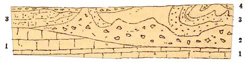
Under Tynemouth, at the mouth of the river, there is a high cliff of stiff Boulder-clay, about 50
or 60 feet in height, facing North Shields. Stones and boulders large and small are scattered all
through the clay from bottom to top approximately in the following proportions:—
There are several irregular thin bands of gravel and sand in the Till. It will be observed that
excepting two insignificant outlying patches of Magnesian Limestone at Tynemouth, all the rocks
up to and beyond the borders of Scotland belong to the Carboniferous series, and the result is,
that of the ice-borne erratics, 80 per cent. belong to these formations, and only 19 per cent. to
the more distant Silurian grits of the Lammermuir range.
At Sunderland, about a mile north of the harbour light, there is a section of boulder-clay lying
on the Magnesian Limestone. The surface of this rock has been polished by glacier ice, and the
striations trend very nearly from north-east to south-west. The overlying
[Boulder-Clay. 389]
clay has the character of genuine Till, and the change in the direction of the striations
from those previously noticed, may possibly be due to the pressure of the inferred Scandinavian
ice-sheet, which is supposed to have united with that coming from Scotland, and may for a space
have deflected the line of its onward march from the NNW. On the other hand, it may be a mere
local accident connected with a later part of the Glacial epoch, when a distinct individual glacier
flowed from the far western watershed, more than a thousand feet in height, about the sources of
the Wear, which may have spread into a fan-shape as it reached what is now the shore. Such
smaller glaciers existed, for in these long dales of Durham and Yorkshire there are distinct
moraines, which mark the gradual decline of the glaciers, and through which, and through the
Boulder-clay, the rivers have cut their modern channels.
Stones derived from the Magnesian Limestone first appear in the Till south of Tynemouth. In the
neighbourhood of Sunderland, the percentage of various kinds of rocks seems to be nearly as
follows:—
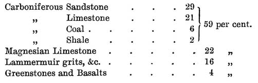
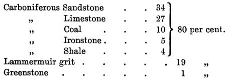
The cliff is about 30 feet in height, and shows the section given in fig. 82.
The Till seems to have been worn on the surface
before the deposition of 3 and 4.
It will be observed by consulting any geological
map, that, as in the previous case, the large percentages
[390 Glacial Epoch.]
of Carboniferous rocks have travelled from the widespread Carboniferous country to the north,
that the smaller percentage of Magnesian Limestone fragments must have been derived from the
small area immediately
FIG. 82.
1. Rotten nodular Magnesian Limestone.
2. Stiff brown Till with blocks and scratched stones. The largest are of Carboniferous Limestone
and Magnesian Limestone, from 1 to 1 1/2 yards in diameter, and 1 block 2 1/2 feet of Lammermuir
grit.
3. Sand and loamy beds with scratched stones, rare.
4. Finely laminated clay.
north of Sunderland, occupied by that formation for a distance of about 9 or 10 miles, and the
decreased proportion of Lammermuir rocks have had to travel not less than 70 miles.
Somewhat further south we find 57 per cent. of Carboniferous rocks, 32 per cent. of Magnesian
Limestone, and only 9 per cent. of Lammermuir grits.
About half way between Sunderland and Seaham, where on a sea-cliff stiff Boulder-clay or Till
lies on the Magnesian Limestone, the latter is covered with glacial groovings which run from
NNW. to SSE. and all along the sea-cliffs of this neighbourhood there is a lower Boulder-clay
with a very irregular surface, on which there lies sand and gravel, often very much contorted,
which in its turn is overlaid by patches of an upper Boulder-clay.
[Boulder-Clay. 391]
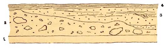
At Seaham ironworks and elsewhere, such sands and
gravels in the middle of the Till frequently thin away in wedge-shaped ends.
FIG. 83.
1. Magnesian Limestone.
2. Lower Boulder-clay.
3. Sand and gravel.
4. Upper Boulder-clay.
It is unnecessary and would be wearisome to the reader, were I to describe all the details of the
sections I have examined between Hartlepool near the mouth of the Tees, and Spurn Point at the
mouth of the Humber. Suffice it to say that, in the Liassic and Oolitic region of Yorkshire, the
valleys that open upon the sea are apt to be more or less filled with boulder-clays, sands, and
gravels, and the same phenomena occur in many parts of the high sea-cliffs. Thus at Cromer
Point, about 2 1/2 miles north of Scarborough, there are beds of sand and gravel in places about
120 feet thick, which lie on an undulating surface of shales, &c., of the Oolitic series. The
embedded pebbles largely consist of sandstones (Oolitic in part), grits, porphyry, &c., and at
the top, about 130 feet above the sea, there are beds of clayey gravel with small stones and
fragments of seashells.
In Cayton Bay, about three
miles south of Scarborough, lying upon Oxford Clay, there is Boulder-clay,
with a great variety of boulders of Carboniferous Limestone, Lammermuir grit,
basalts, greenstones, and other rocks that lie nearer the spot. Many of
these are subangular and many are well rounded, and both kinds are
[392 Glacial Epoch.]
often marked with glacial scratchings. Above this Boulder-clay there are beds of gravel with
fragments of marine shells, and the embedded stones only show the ghosts of scratchings, as if
they had been nearly obliterated by trituration. Above this gravel, Boulder-clay again occurs in a
little hollow, in which there are deposits of fine clay and shell-marl, with Paludinas, &c. The
relics of such old pools are common on the surfaces of irregular deposition of the boulder-clays
all the way from Northumberland to the Humber, and doubtless far beyond.
On the coast, from one to two miles north of Bridlington, lying on chalk, there are beds of Till
interstratifled with beds of sand and gravel, parts of the Boulder-clay among the Till being much
contorted. In one case they were seen to lie in an old valley of erosion in the Chalk, the lowest
strata consisting of stratified brecciated chalk gravel, overlaid by sand, on which there rested
chalky sand and gravel, which in its turn is overlaid by Till with irregular minor
interstratifications of sand; and in another case, about three miles north of Bridlington,
fragments of sea-shells occur in the gravel about 150 feet above the sea. Near Bramston, in
Holderness, a few miles south of Bridlington, on the shore, there are large boulders of gneiss,
basalt, diorite, &c.
Immediately north of Hornsea, about twelve miles south of Bridlington, the Till, which partly
forms a seacliff fifty or sixty feet high, is very irregularly bedded, and contains numerous
scratched stones of flint and chalk, Carboniferous Limestone (more scarce), Silurian grit,
granite, gneiss, &c. The quantity of stones of chalk is quite a new and remarkable feature in the
section, for north of Flamborough Head, in the Oolitic country, I found none. The Till, which
forms the base
[Boulder-Clay. 393]
of one end of the cliff, is overlaid by sand and gravel, which again is overlaid by lenticular
patches of Till, covered by higher gravels, on which, in a hollow, there occur clays with
Paludinas deposited in an old freshwater pool. The same kinds of sections, with variations, are
found all the way from Hornsea to Withernsea and Spurn Point, and here and there many large
boulders of granite, Carboniferous and Lias Limestones, Sandstones with Stigmarias, &c., lie on
the shore, bearing witness to the recession of the cliff, which is fast wearing away under the
united influence of landslips, and the action of breakers and tides on the fallen masses of clay.
Nor do the remains of sea-shells cease, for at Out Newton, by the shore, the base of the cliff, in
which frequent landslips occur, consists of stiff blue Till with erratic blocks and many
fragmentary shells, overlaid by clay with smaller stones, on which lies well-stratified warp
clay, surmounted by beds of sea-sand and gravel, which again is overlaid by red Till with
scratched stones. On the shore of the Humber, also, when excavations were in progress
connected with the building of a fort, beds of sand, gravel, and warp were exposed, containing
sea-shells intensely contorted, as if the strata had been subjected to strong lateral pressure.
Between the Humber and the Wash I have no personal knowledge of the coast sections, which are
of the same general nature as those of Holderness. South and south-east of the Wash, as far as
the neighbourhood of the Thames, much has been written about glacial detritus, with the details
of which I will not now meddle. It is enough to state that by Mr. Searles Wood, junr. and Mr. F.
W. Harmer, they have been divided into Lower and Upper Boulder-clays, between which there
are beds of sand and gravel, often contorted,
[394 Glacial Epoch.]
thus presenting points of resemblance to the sections on the coast which I have described
between Berwick-on-Tweed and the mouth of the Humber. These sands and gravels which contain
sea-shells have been named by these gentlemen 'Middle Glacial.'
The Upper Glacial Boulder-clay
has been called by Mr. Wood and Mr. Skertchly the great Chalky Boulder-clay,
from the circumstance that it chiefly consists of chalk, ground up by an
advancing glacier travelling frcm north-east to south-west, the chalky and
flinty debris being sparingly mingled with fragments of Oolite, quartz, basalt,
granite, &c., sometimes smooth and striated. Though chiefly formed of
chalky material, yet when found lying on Kimeridge Clay it is found to be
mingled with the detritus of that formation, and when it reaches the Oxford
Clay, all three are intermingled. The Boulder-clay lying on each formation
that lay under the glacier icesheet, which was invading the country from
north to south, always partakes of the nature of the underlying rock, and
the total area occupied by this chalky Boulder-clay must, according to Mr.
Skertchly, have been more than 3,000 square miles in the south-east of England.
If, however, this supposed glacier extended as far south as Romford, where
there is Boulder-clay with scratched chalk-flints and masses of Oxford and
Kimeridge Clay, then the area covered by the great Chalky Boulder-clay and
its southern continuation instead of 3,000 square miles must have covered
9,000 or 10,000 square miles of ground.
It must now be evident to the reader, that on the east coast of England, and on the adjoining
ground in the interior, there is no want of evidence of a cold episode or of episodes when snow
and glacier-ice largely
[Boulder-Clay. 395]
prevailed in these regions under some form or other. A minority of persons who excel in the art
of doubting will of course dissent for a time, but the proof is too strong to be withstood by
commonplace minds. On the whole, also, it would appear that the complete glacial deposits of the
east of England consist of Lower and Upper Boulder-clays, between which there lie stratified
sands and gravels containing sea-shells, and that these strata were deposited in the sea during a
temporary intermision of the cold of a Glacial Epoch. Shells, sometimes fragmentary arid
sometimes entire, are also found plentifully enough in the Boulder-clays of Holderness and
elsewhere.
In older times the origin of these Boulder-clays was attributed chiefly to icebergs that, laden
with moraine matter, broke from glaciers that descended, during a period of partial
submergence, to the sea, and which, floating south and melting, scattered boulders and stony
debris mixed with fine mud across the bottom of the sea.
But of late there has been
a tendency in some writers to attribute the origin of all, or almost all of
the British Boulder-clays to the direct action of glaciers, and to look upon
them as ground-moraine matter, the moraine profonde of Swiss and French authors,
which is supposed to have a modern parallel in the vast quantity of debris,
believed to underlie and be pushed forward by the mighty ice-sheet that passes
seaward from the great basin of central Greenland, and finds its vents through
unnumbered fords into Baffin's Bay. On these grounds both the Boulder-clays
of the east of England, are looked upon by Mr. Skertchly as having been formed
by the direct action of glaciers, the upper Boulder-clay being the work of
the larger and later ice-sheet,
[396 Glacial Epoch.]
when it so happened that the cold of that region became most intense.
Assuming this theory to be
true, the old glacier must have reached the plateau of Romford that overlooks
the valley of the Thames, and the low country on the coast of Essex, near
Southend. One serious difficulty to its acceptance occurs in the fact, that
on the coast-cliff near Lowestoft there are beds of Boulder-clay which overlie
thick strata of soft false-bedded sands with gravel, and these sands lie
apparently quite conformably and undisturbed beneath the Boulder-clay. If
the latter was the ground-moraine that underlay a heavy glacier pressing
southward, it is hard to understand why the sands show no signs of pressure
and glacial erosion. Neither is it necessary to suppose that glaciers are
always needed for the production of ice-polished surfaces of rock and for
the making of Boulder-clay, for, as shown by Professor H. Youle Hind, the
formation of both on a large scale is now and has been for long in progress
on the north-east coast of Labrador, through the agency of 'Pan ice,' which
'is derived from Bay ice, floes, and coast ice, varying from five to ten
or twelve feet in thickness, all of which are broken up during spring storms.'
This broken ice is pressed on the coast by winds, 'and being pushed by the
unfailing Arctic current, which brings down a constant supply of floe-ice,
the pans rise over all the low-lying parts of the islands, grinding and polishing
exposed shores,' and removing 'with irresistible force every obstacle which
opposes their force . . . and the masses pushed or torn from those surfaces
. . . are urged into the sea and rounded into boulder forms by the rasping
and polishing pans.' Here, too, goes on the process of manufacturing Boulder-clay,
for the deep hollows and
[Ice-marks. 397]
ravines, at present under the sea, the records of former glacial work, are being filled with
clay, sand, unworn and worn rock fragments, producing a counterpart of some varieties of
Boulder-clay.1 I have quoted thus far from Professor Hind's admirable memoir, for it has
sometimes been stated, that all the contorted Boulder-clays and interbedded sand, with shells
entire and broken in England, were pushed bodily upon the land by a vast advancing sheet of
glacier-ice, even to heights of a thousand and twelve hundred feet. As the British Islands during
the Glacial epoch were more than once much in the same state as the north of Labrador, there
can be little doubt that some of the British glacial phenomena were produced by the same causes.
1
See 'Notes on some Geological Features of the North-Eastern
Coast of Labrador,' by Henry Youle Hind, M.A., 'Canadian Naturalist,' vol. viii.