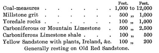
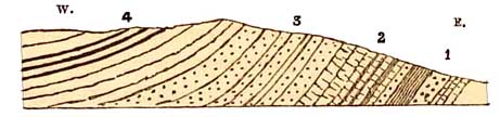
Dean Forest may be looked on as an outlier of the South Wales coal-field. Fig. 27 may be supposed to represent the arrangement of the strata on the east side of this very perfect basin. The limestone is about 7001. Old Red Sandstone.
Carboniferous Series:
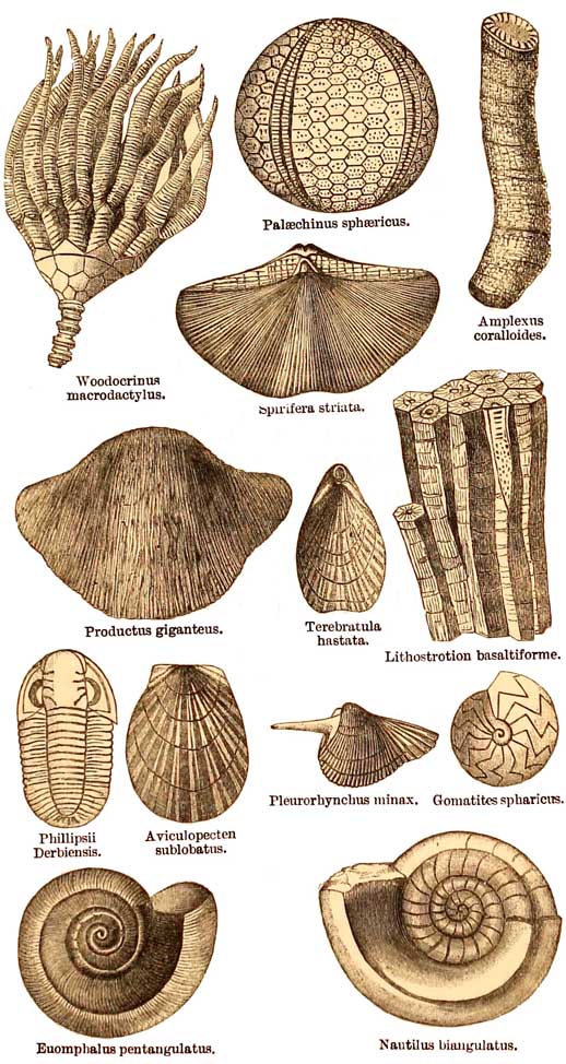
2. Carboniferous Limestone.
3. Millstone Grit.
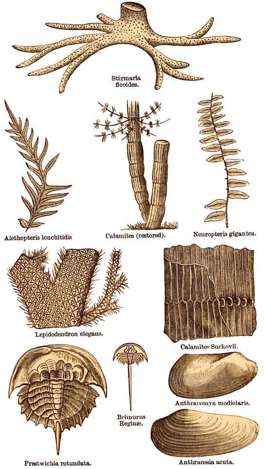
4. Coal measures with beds of coal.